Day Six: Ballantrae to Girvan
- David Gardiner
- Jun 17, 2021
- 4 min read
Today was another split day, with some challenging road walking thrown in for good measure. It was both a really good and really tough day.

It all started with a tasty breakfast from my host at The Haven, and I set out about 9am. On reflection, I decided to forgo the invitation to join her at church at 11.30. With thirteen miles ahead of me, I wanted to get at least a few under my belt before 12.10, when the service was due to finish.

The beach and harbour at Ballantrae passed quickly, helped by the fact that I’d explored it all before. The sea was a stunning blend of turquoise and deeper blues, and the stronger wind (the more usual situation at Ballantrae, I’m told) kicked up bigger waves and small white horses.


After passing the garden centre where I’d had lunch the previous day, the path quickly descended onto the beach to follow it for two miles to the next headland. As had happened a few days earlier, the tide this morning was far enough out to allow walking on the firmer damp sand, although even that sand was quite soft here. With the wind behind me, I also again had the treat of seeing light sand blown in intricate patterns across the darker sand, dividing and merging around the pebbles in the sand.


It was good walking, and I quite quickly found myself at the end of the beach, climbing up to the dunes as the path there crosses the A77 to climb up the headland. Unfortunately, the A77 is a very busy route, a trunk road with a 60mph speed limit. Crossing is not hard, but the path then hugs the verge of the road, which isn’t always stable underfoot. It’s noisy and busy, and one has to repeatedly make the choice between treacherous footing on the grassy verge and stable footing closer to the traffic on the tarmac.


It’s a long slog up to the summit of the headland, and then the hiker is encouraged to cross the road just before a car park at a wonderful viewpoint. This was where I decided to take my first break of the day, with a cup of tea and excellent views of Ailsa Craig, which has come to dominate the views today.


For those who don’t know, Ailsa Craig is a distinctive cone-shaped island off the coast of south Ayrshire. It stands about 1100 feet tall, ten miles out to sea. It’s formed of very hard form of granite called “blue hone” microgranite. It’s an attractive stone that has long been quarried from this one source for curling stones.

Leaving the viewing point, the path resumes its habit of hugging the A77. I took the opportunity of a different path diverging from the road to leave the traffic behind. This minor path descended quickly and then wove between small properties and then a holiday park at Lendalfoot. It may not have been the official path, but it was a lot more pleasant!


A couple of miles further on, we again approached a headland, and this time after crossing the A77, the path rose a fair distance inland of the road. Wild, bare hills rose even further inland, and the view quickly opened out to sea.


The first field I passed into seemed empty until about halfway through it; as I climbed, I noticed a much larger outcropping of the white stone present in a few places around the hillside. Then, as I kept climbing, it became clear it wasn’t stone, but the white hide of a sitting cow. As I passed this placid beast, it struck me that it was a very large cow. A single, large cow. Alone in a field. With another field across the glen filled with many cows, separated from our field by a sturdy fence. Have I mentioned that my backpack is red?
I forced myself not to quicken my pace.
Happily, the bull really was quite content to bask in the morning sun, watching me with what I chose to interpret as a kind of friendly disinterest. The exit from the field was not far.

The path followed the contours of the hill for two miles, passing from cattle fields to sheep fields, where I met three sheep who trotted ahead of me and *really* needed a haircut.


We returned briefly to the roadside, where I met a lady who I spoke to briefly. She is a motorhome adventurer, and we shared stories of places we’ve been. She had met a chap the previous evening who paddled his canoe into the bay where she was parked, set up a tent, and set out again the next morning in short order. Apparently he is in the midst of canoeing from John o’Groats to Land’s End down the west coast.


Soon I was climbing the third headland of the day, up the steepest path yet, through what appeared to be some kind of abandoned quarry. As I reached the top, I noticed a Lifeboat speeding south, followed a few minutes later by a helicopter going the same way. Both returned within the next half hour, and I hope all was well, or that it was some kind of training exercise.
From the top of this final headland, Girvan was clearly visible ahead. Indeed, the curve of the land beyond Girvan, including tomorrow’s destination of Culzean, was also visible. Unfortunately, the last four miles into town involved a lot more rough walking along or beside the busy A77. There were a couple of points of relief, but the noise and presence of fast moving traffic came to dominate the last couple of hours of the day’s travel.

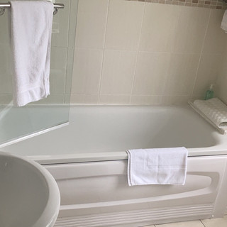
I’m pretty tired now, and will leave the rest of the telling of the day to photography. I’m installed in a lovely room at the very pleasant Southfield Hotel, including an actual en-suite bathtub. It’s been a varied day, with emotional and physical highs and lows. The walking has come to feel a bit easier, although the trudge at the end was hard on my feet and has left me weary. Tomorrow ends in the beautiful grounds of Culzean; I pray my feet and the Ayrshire Coastal Path can cooperate to get us there!


Comments